Menu di navigazione

You are in: Home page > Magazine Archive > The rough edges of the "expanding town"

Andrea Sciascia
The rough edges of the "expanding town"
Projects between Palermo and Partinico

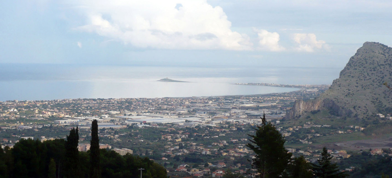
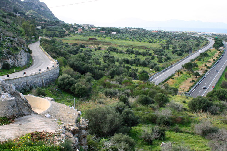
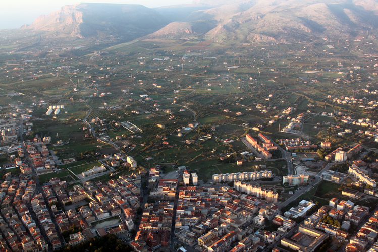
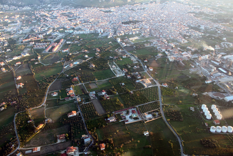
The project areas.

Research Unit of Palermo, where Prof. Andrea Sciascia is responsible, focused on the territory west of Palermo between Isola delle Femmine and Partinico. In this context, Palermo and Falcone-Borsellino Airport exert a special and contrasted action. This effect manifests itself on "green" agricultural or residual areas, which are often the margins between the dense cores included in the study area (Isola delle Femmine, Capaci, Carini, Cinisi Terrasini and Partinico). According to the text by Giuseppe Samona about the Expanding Town, some of these fringe areas, appropriately selected, have been redesigned to envisage a possible alternative to the urbanized countryside.
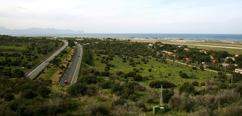
Punta Raisi airport is located on the west coast of Sicily, about thirty kilometers from Palermo. It produces a centripetal force between the slopes and the northern fringes of the town. In according to Prin 2009 for the Research Unit of Palermo, this area provided a natural laboratory to study the concrete effects produced by centripetal action of the airport, as opposed to those historically emanated by the compact nucleus of the original Panormus.
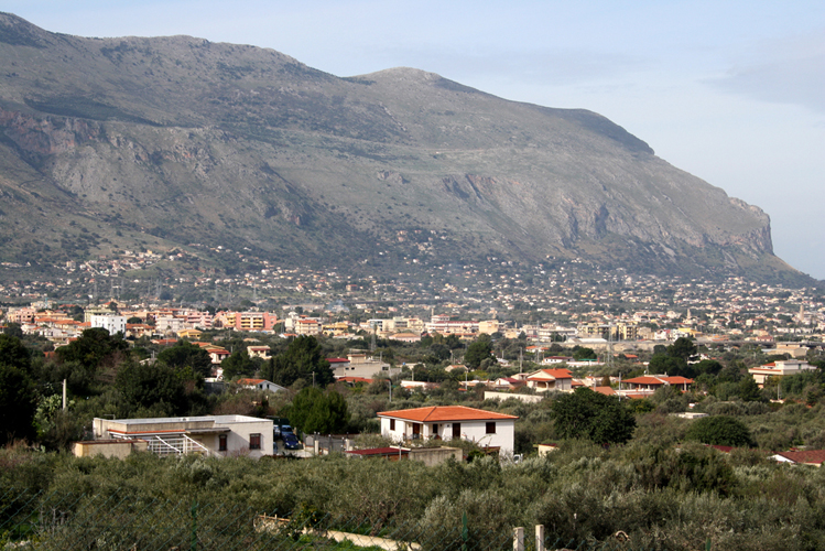
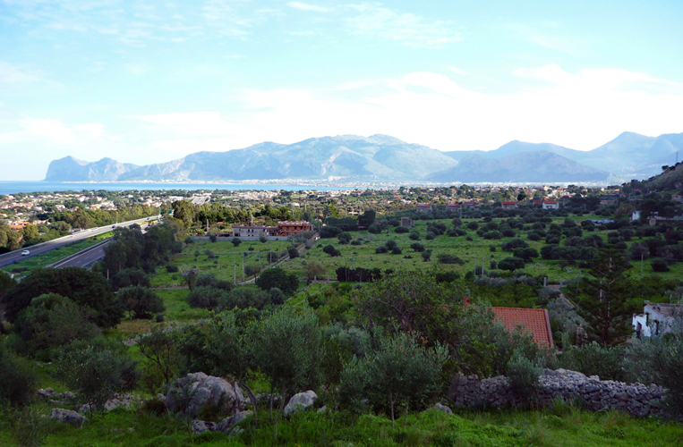
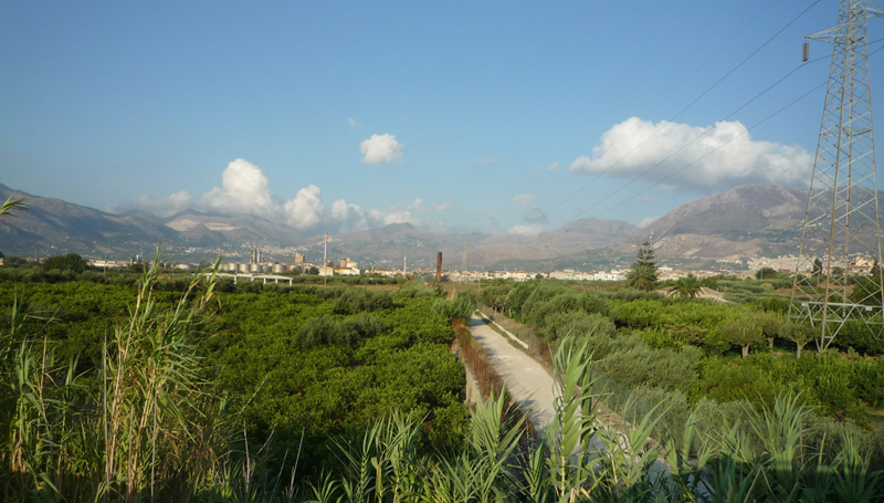
To understand what really happened it is necessary to emphasize, in the description of this portion of the territory, the coastline, the mountain system and various towns such as: Isola delle Femmine, Capaci, Carini, Cinisi and Terrasini. The dual polarity formed by Palermo and the airport act, today, on those agricultural areas which in reality have become increasingly worn and of the areas which are generically "green" spaces, constituting a kind of residual amniotic fluid among the densest urban places mentioned above.
In order to examine the nature of this liquid we must first consider the most viscous parts composed by small lumps, and formed by clusters of trees, bushes and agricultural crops. The nuclei be they "hard" or "soft" seem to float within the liquid, mutually lost. Acknowledgement of their consistency coincides with the study of the transformations taking place of residual countryside. The focus could be confined to recognize in the fluid as the object of the study: the characteristics of the sprawl. However the phenomenon is more complex. In the disorder of this fragmentation stands the loss of the attractiveness of towns, the demise of profitability of agricultural crops and a prevalence of infrastructure in the design of urban expansions.
These elements, in form and position, have no connection with either the city or the countryside. these elements that shape and position have no relationship with the city, nor with the countryside, this observation assumes an insight oriented, a reading that has its roots in a theory or, at least, a reflection that can evaluate carefully how the shape of the building can be composed with the countryside, avoiding the fragmentation of the first into the second. With these assumptions, the text by Giuseppe Samona The town in extension (1976) has become topical again. In this text the Director of the IUAV envisages a possible alternative to the urbanized countryside, finding in the search form a possible compatibility between town and country.
Samonà focused, initially and especially on "the relatively large building units, although not exceedingly large; agricultural countryside, which includes these villages and detached houses that are scattered, and finally, the large geographical uninhabited areas that form the ecological reserve, biologically necessary and largely mountainous"(Samonà 1976, p.3).
Excluded from consideration "the ecological reserve biologically necessary and largely mountainous" is in fact uninhabited, the observation in the territory west of Palermo, in the wake of Samonas theory, pushed to include, among the areas to be studied, even those belonging to the territory of Partinico, located in Terrasini, for which the words of Samonà fit pertinently, to what has been called the amniotic fluid stretches out into much larger mirrors when compared to fragments distinguishable in the perimeter initially set.
How to identify the agricultural year which may contain little towns or detached houses? The places of research, after a series of visits and subsequent sketches and photographs, have taken shape from rational overlay maps of the archive from the Department of Regional Planning SITR (Geographic Information Systems Mapping - Assessorato Territorio e Paesaggio-Sicily). The following maps have been superimposed and compared:
The IGM map of 1971, the Regional Technical Map (CTR), the hydrogeological Plan, the Nature map, the Soils map; Orthophoto upgraded to 2008. The current General Regulatory Plan (P.R.G) has been found at the Technical Departments of the Municipalities of Cinisi and Terrasini and the geological plates of the study areas at the Higher Institute for Environmental Protection and Research (ISPRA).
The comparison of the listed maps resulted in a new and original plan of free areas containing minutes of the building units including between Isola delle Femmine and Partinico. The framework, within which, together with the path of the highway, two other lines are established: that of the 113 highway and the railway lines of Palermo-Trapani. The two lines can be identified as: the infrastructural and geographical emergencies from east to west (Muletta, Pecoraro, Colombrina, Castellaccio, Anello, Longa, Ceresia, Saraceno, Palmeto and Cesarò Mountains).
Project themes have been drawn up for resulting areas from the overlap of the maps, in consideration of the urban plan and the demands of the agricultural vocation of the places. However, the choice fell between those where it is still "possible to give a proper shape to the countryside so that its parts can be designed in a unified whole that has, in terms of shape, a common root in the set of rules that relate to the new dimension of interagency working between muncipalities and districts both to regulate the building artefacts that agricultural areas " (Samonà, 1976, p.6).
Among the nine areas initially selected, issues concerning five of those that fall respectively have been brought to the attention of around thirty project teams, from various Italian Faculties of Architecture, namely: two in Carini, one in Cinisi, near the airport, and two in Partinico. This search method follows that of Pasquale Culotta (Prin 2002).
The projects, in some cases, question altogether hundreds of acres, most of which are invisible in the daily experience of living. These are imperceptible because of fences generated by buildings, roads, hidden industrial plants, much of the city, as well as the countryside, the potential that today is possible to observe only from a bird's eye perspective.
The various proposals for the five project areas can be divided into two broad sets summarized by two Latin words: limes and limen.
All projects collected, in fact, live in this tension between establishing a boundary or point out a certain threshold of access. Forma Urbis and open connections between town and country can be restore planning in a different interaction between the one and the other. All projects draw a large New Town. Maybe not exactly the town in extension envisaged by Giuseppe Samonà but a variant in which buildings and cultivated fields can seek a balance. In some cases, the dialectic between the two parties is regulated by rough edges. That are not always resolved according to the architect of Palermo instructions. But these edges testify, the willingness to go beyond the inevitable fate of the dispersed city, made exhausted by the absence of shape.
Bibliography
Clement G., (2004). Manifeste du Tiers paysage, Sujet-Objet, Paris.
Doglio, C., Urbani, L., (1972). La fionda sicula, Il Mulino, Bologna.
Donadieu, P., (2006). Campagne urbane, Donzelli, Roma 2006 (I ediz. 1998).
Samonà, G., (1976). La città in estensione, conferenza tenuta presso la Facoltà di Architettura di Palermo il 25 maggio 1976, Stampatori tipolitografi associati, Palermo.
Assunto, R., (1973). Il paesaggio e lestetica, Giannini, Napoli.
Samonà, G., (1975). L'unità Architettura Urbanistica, Pasquale Lovero (a cura di), Franco Angeli Editore, Milano.
Sereni, E., (1961). Storia del paesaggio agrario italiano, Laterza, Roma-Bari.
Andrea Sciascia is Professor of Architectural and Urban Composition at the Faculty of Architecture of Palermo. Since 1995 he has been carrying out research at the Department of Architectural History and Projects. Coordinator of Masters degree course in Architecture.


Area of study. Orthophoto.


